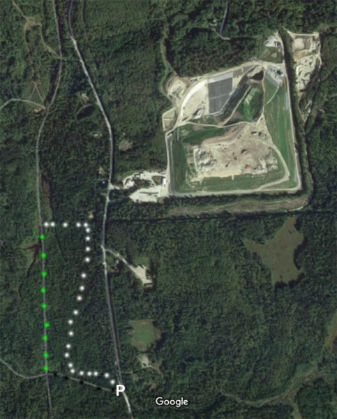
About noon I saddled up and drove my truck to a pull-off near the south end of trudeau Road in Bethlem, New Hampshire. On the west side of the road is a bog-like area formed by Beaver Brook and tributaries as it flows into a flat area.
Because we have been experiencing something of a drought, I thought it a good time to explore that area since water levels are low and the land may be traverse-able on foot without sinking up my ankles and knees in mossy mud with every step.
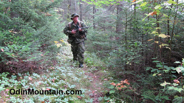
As an experiment I added a pouch to the belt on my BDU pants in which I put my maps, surveyors compass, notepad, and pen. I obtained the pouch from one of the local big box stores in the outdoors and hunting section.
While this pouch would allow handy access to maps and compass, I was thinking it’s bulk could hinder me while going through thickets and other closely spaced objects which make forest travel difficult. Only by actually using it in real-world conditions would I know for sure.
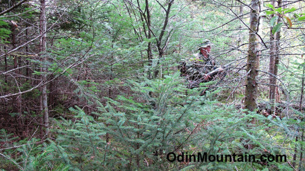
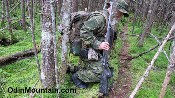
A short distance from the truck, the forest is a very thick mixture of young hardwoods and softwoods, difficult to penetrate in places especially when carrying a full load of gear (rifle, belt, battle belt, and three-day pack). On this trip I wasn’t carrying a shoulder bag, as I often do but loads are necessarily bulky and counting the rifle I carried some 40-pounds.
This is typical of the Great North Woods, making site distances short, often only a matter of fifty feet. 50 yards is can be a long shot in this forest.
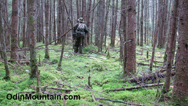
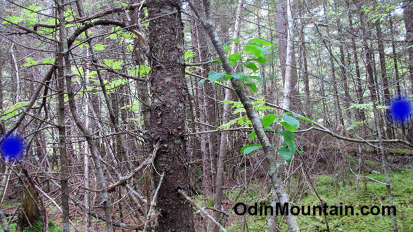
Heading roughly North by NorthWest using a button compass as a basic guide, the land quickly dipped down into the flat bog-like area. A thick green carpet of mosses in a spruce-fir forest containing the usual blow-downs and narrow passage ways.
Without the compass, and having to wind my way around trees, blow-downs, and wet areas, and with no visible land forms to orient myself, it would be difficult to keep a reasonably straight course. Often even the position of the sun is difficult to observe from the gloom of the forest floor.
As hoped, the land was relatively dry compared to its typical condition had the area received it’s normal supply of rain this Summer and early Fall.
While the going was certainly flat as compared to most of my mountain training, it wasn’t any easier going. Much of the energy for each step was taken up by my foot sinking deeply into the soft moss, much as when you sink into deep snow while walking. Then as you raise your foot for the next step there isn’t much of a solid surface to spring off from.
This is good information to know – on a map you may see what looks to be a flat easy section of terrain and so choose that as your intended route, only to discover you would have been better served taking the higher, albeit steeper but dry route.
From aerial photos you may not interpret that flat area to be boggy because it is also covered in forest. But with experience you will learn to come to expect potential boggy conditions when the topo map contours are widely spaced and aerial photos show a spruce and fir forest.
Along the scout at intervals I stopped and quietly listened and observed for ten minutes, as is the way of scouting.
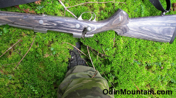
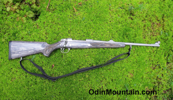
At one rest stop Gungnir the .375 H&H Sako Stainless Steel elephant rifle chose to nap on plush bed of emerald green moss. In places this moss is so thick and luxuriant it nearly buried my foot with each step.
Southwesterly, in the distance, I heard the distinct pounding of hammers to nails for several minutes. It being hunting season for black bear and soon for whitetail dear, it may be someone is making a hunting blind of some sort.
Of course hunting blinds can be used for a wide variety of game, including man.
Ravens croaked from time to time, and once a pack of Blue Jays became very agitated out of sight a hundred yards to the right. Noisy bird behavior is often a sign I have driven an animal in that direction in order to avoid me.
I saw plenty of evidence of whitetail deer, black bear, moose, and coyote. Tracks and scat, with occasional hairs left on branches as the animal passed by.
Because there is a huge, active landfill nearby, many scavengers are attracted to the area. Alas, they often consume plastic bags, etc that contain residues of meat. Their plastic filled scat was everywhere in the forest. Scat that has long since deteriorated has left behind various plastic and glass rubbish the animals had consumed.
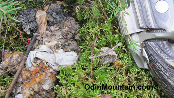
Something of an ecological disaster that dump is!
I knew the area I traversed was bounded by a US Forest Service woods road to the south and to the west a long abandoned logging railroad from the 1800’s now occasionally used by snowmobilers, mountain bikers, and hikers. Because of the necessarily winding, wending way was forced to take through the thick forest, I accidentally came near the US Forest Service road, as I noticed to my right a linear section of the forest that shown brighter in the general forest gloom that surrounded me.
Observations such as this are important to a scout and a reason we carefully observe our surroundings as we travel and take dedicated observation stops at intervals. Bad things can happen should you be pushing through brush and forest parallel to and just off from a frequently traveled trail or road.
Alternatively, you may be in need of a trail or old logging road in order to speed your advance, save energy instead of having to get through the obstacle-course that forests usually are, or to even just figure out your position relative to a map and your intended route.
So learn to look through the forest instead of at the forest, and study the clues various shades of light and contrast convey to you. This is something you can only learn from experience and the reason I stress actual field work above all else.
Another case in point, further on and to my right I noticed the metal roof of a small cabin-like structure. Barely visible through the thick growth, what gave it away was it’s square linear shape, enough of which I could see between a myriad of leaves and branches between it and I.
Again, walking too closely to a structure or developed place can be problematic indeed.
Eventually I came upon a well-developed animal trail. This trail is so much used to have cut a rut into the soil and worn away tree roots, much like the hiking trails frequently by humans in these mountains. The only difference is the animal trail is much narrower than a human trail, and the animals that use the trail go underneath or over blow-downs (or around them if need be).
Still, the animal trail is much easier walking as they have broken out branches (or kept branches from growing) as they repeated walked through. A bit narrow for a human, perhaps, but probably saving half the effort needed to plow through the obstacle course without the trail.
Intrigued, I decided to follow the trail in it’s northerly direction. It seems the wild animals developed this trail as a means of traveling from the Bethlehem area, past the dump, and thence into the Mt. Garfield area mountains whilst avoiding civilization.
I plan to explore this animal trail further at another time. Suffice it to say that knowledge of this trail can come in handy and be a real advantage in time of need.
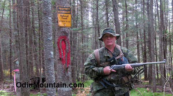
Eventually the animal trail cut a National Forest Boundary line, which is typically blazed in red. At this juncture is an old overgrown logging road which I followed southerly to the abandoned logging railway line and thence back to my truck.
In the boggy wetland explored today I found no evidence of humans. Few people would go in there, the way generally being wet and miserable. Anyone who tries can be literally bogged down and sapped of energy while fighting the swamp.
For this reason the animal trail is of tactical knowledge. The trail can be used to avoid the roads and still get to some destinations without having to fight the forest nearly so much as off the trail.
Of course, one must always be careful when using trails as they can be booby trapped in anticipation of someone utilizing them.
At this point an old narrow, disused woods road headed southerly and I took this in order to cut the old logging railway line and thence back to my truck.
This was certainly a good, relatively short scout. I explored an area off the beaten path and yet very close to civilization. Knowing of the animal trail that cuts through the area and makes concealed travel easier could come in handy one day.