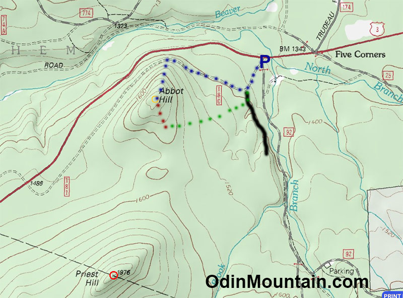
This morning I chose to scout Abbot Hill (elevation about 1720 feet) which is just south of Route 3 while carrying nearly a full three-day load except for food.
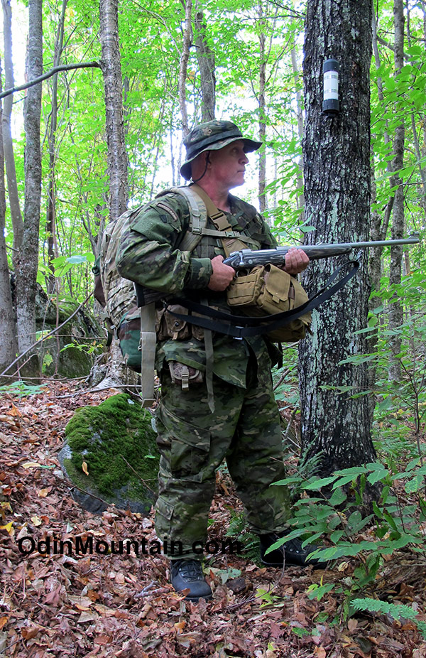
Gear on my belt, battle belt, shoulder bag, three-day pack, and rifle totaled about 61 pounds, which is a considerable weight to carry off-trail in dense forest and steep mountains.
This includes two quarts of water. Ammo carried was eleven four-round magazines plus one in the rifle plus one round in the chamber plus 20 boxed rounds for a total of 69. Elephant gun ammunition is heavy stuff.
If you figure about 2.5 pounds per day for food a “real” 3-day scout with the same basic gear would bring the weight to 68.5 pounds.
In the lower elevations this time of year the temperature will go down to about 20-degrees F and carrying this weight of gear means I would be sometimes “living cold”, that is “carry light, freeze at night”.
Alas, for a typical backpacker this pack weight is about twice that considered a full load for an entire week.
There is something more. Having been a weightlifter for sport all my life, I am 5-ft 7-inches 216 pounds. This means I carried some 277 pounds all told on this scout.
To start the scout I parked my truck at the dirt parking lot just before the gate at the intersection of Route 3 and the west end of the US Forest Service Gale River Loop road. There was one other car parked there.
Upon dismounting, I carried my gear and rifle to the open gate of my truck where I set it down and began to put it on. Two women bear hunters suddenly emerged from the woods, carrying day packs and bolt action rifles, wearing full camo.
Just my type.
At this spot the old Route 3, now in disuse for decades and partially overgrown, is blocked off to vehicular traffic by large boulders. I followed this old road to a position about directly north of the Abbot Hill summit and then headed steeply upward several hundred feet in elevation to the top.
Although relatively short in distance, the going was quite difficult due to it being very steep, very rocky, and having numerous blown down trees to negotiate around.
It was especially difficult for my toes. Having to spring off them with each at such a steep angle carrying a heavy weight, there was some risk of spraining a toe.
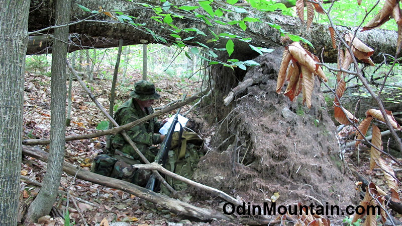
At one point, due for a rest stop, I came upon some particularly good all-around cover and concealment.
Several very large hardwood trees had tipped over during a windstorm, roots and all. This made a sort of cave underneath the trees the roots of which had probably tons of soil and rocks embeded.
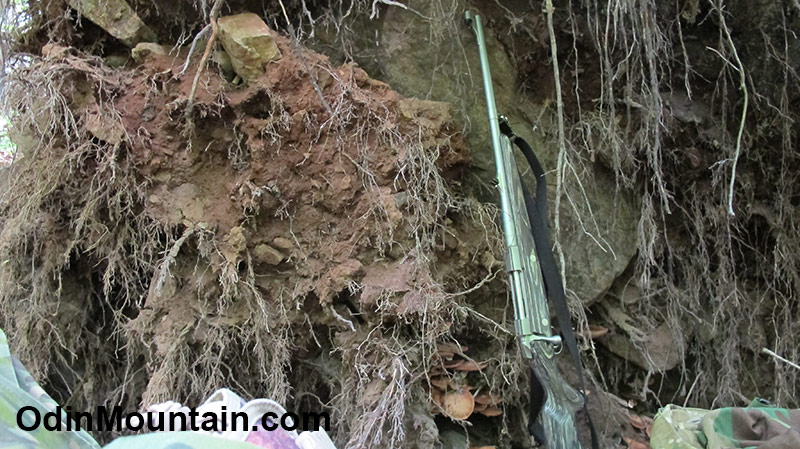
The power of falling trees is quite amazing, in one of the pictures is the large rock that had been ripped from the ground by the root mass as the tree tipped over. This would certainly provide cover.
At the summit of Abbot hill someone has bolted a PVC canister to a tree. Unscrewing the container reveals a notebook and pencil onto which five or six bushwhackers have signed since the Spring of 2012 some 4-1/2 years ago.
Many of the trailess hills and mountains have these registers, and it’s interesting to see who has gone off-trail exploring. Many of the same names are seen time and again.
I would guess that for every off-trail explorer there are thousands regular hikers who stick only to the officially maintained hiking trails. We are a rare type indeed.
Certainly nobody else carries an Elephant Rifle to these summits.
Near to the trail register and very close to the actual summit is a huge glacial erratic – a boulder left behind by the retreating glacier some 12,000 years ago. I am amazed how many summits have just such a boulder, usually covered in large, ancient lichens.
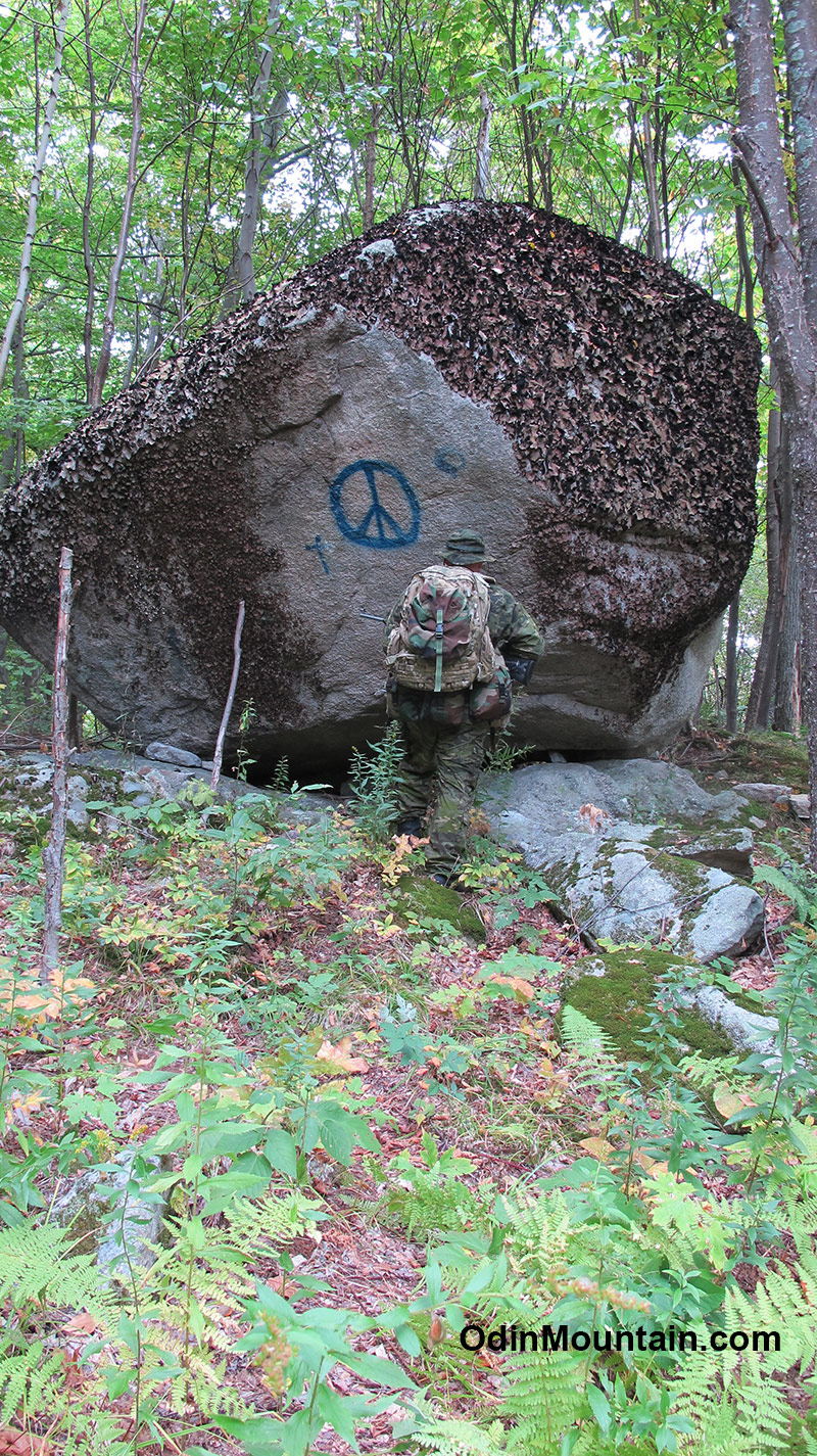
I like to think how this boulder has been sitting there throughout all these thousands of years of history. Mammoths likely rubbed their rumps on its lichen covered side!
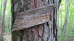
Some dumb-ass has spray painted a peace sign and religious symbol on this beautiful rock. There is also a very old piece of board with “Abbot” scratched onto it, nailed to a tree. It looks as though it has been there a very long time.
After another Listening Rest, where I heard nothing but the sounds of woodpeckers beating on trees, road traffic far below, and a squirrel chattering at me, I explored the summit for about 100 feet in all directions.
Interestingly, on the south side of the big rock and facing the painted graffiti, someone has cleared out a swath of trees southward for perhaps thirty feet, so that now only small low laying bushes remain.
Could this be some sort of personal shrine?

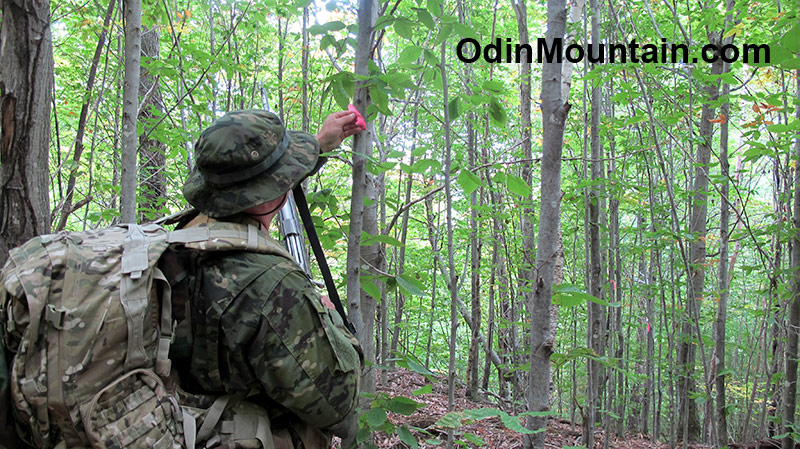
This possibility increased when I discovered colored ribbons attached at intervals to trees that served to mark a distinct trail heading eastwards down the mountain from this cleared area. Because this plastic surveyors ribbon becomes increasingly brittle with exposure to the elements, I felt it and determined it was recently placed – probably last Fall at the latest and most likely this year.
The rough trail is of the type made by someone walking over the same place a couple dozen times in recent months. The forest duff has been flattened and has a slightly lighter color than the surrounding duff.
There is an interesting peculiarity in this persons trail-building technique. Generally he does not cut a path unless the going is through thick brush.
In thickly grown areas he tends to lopp off small trees at a height of approximately four feet. They then sprout vigorously from the top and create a sort of trail marker because they look so much different than regular vegetation.
This would also serve to mark the trail in winter when snow is deep.
If this trail marking technique is purposeful, he may be a clever local outdorsman who I need to become more familiar with.
Intrigued, I followed the ribbons eastward down the mountain along this lightly trod pathway so well marked out. As I thought it would, I came out on an overgrown logging road just south of the old route 3 very near where I started.
His method of ascending Abbot Hill is much easier than mine as it takes a more gentle grade. Carrying a heavy load and rifle, I can certainly appreciate that.
Abbot Hill Scout Debriefing
- The amount of weight carried is critical. Even body weight. A scout has to travel light. I want to loose some body weight even if it means losing muscle mass. Strength to weight ratio.
- Women bear hunters suddenly emerging from the forest highlights the fact there are other people with guns who are purposefully being
stealthy. - There may be a clever local outdoorsman wandering about. In terms of forest savvy he could be a cut above the typical hunter or bushwhacker type that goes off-trail.
- Choose terrain wisely. Being out of breath, becoming physically exhausted, or sustaining injuries due to traversing difficult areas reduce the effectiveness of the scout – and could lead to disaster.
Odin Mountain’s Links
Danger and Play – Apply the OODA-loop in your own life